Friday, November 30, 2007

Flow Regulation


Images of an idea iteration... I'm thinking that the New York Cheddar elements are inflatable and retractable, and the vertical elements are foldable, so the whole system can expand and contract in reaction to traffic flows, slowing accordingly. It would also be (systematically) deployable. Thoughts? Suggestions? Nasty Comments?

Wednesday, November 28, 2007

UAS taxonomy

this is the UAS taxonomy that Edwin and I started. My suggestion is to have one slide for each type, one image per slide, with a simple label.


here's a slide mockup

Tuesday, November 27, 2007

Site Model Projection Central

D.A. Studio:

I thought I would start a thread where we can pin up ideas about how to organize the projected maps for our site model.

One thing we didn't mention at our meeting was the potential to project our walks. It would be neat just to see all of the GPS-mapped walks in one image.

What are the most useful ways to break down the unaccepted streets into bite sized pieces? I'll start with a few--
1. pedestrian way/street/freeway ramp
2. slope
3. width 0, 0-30, 30+
4. sidewalk/no sidewalk
5. adjacent or under freeway/ghost freeway
6. DPW jursidiction?

others?

Monday, November 26, 2007

Free-Range City

GIS online labs/tutorials resource

all -

working in the LAEP computer lab, i noticed someone following these online tutorials - they're labs from a homegrown GIS course for which weimin is the GSI

http://www-laep.ced.berkeley.edu/classes/C188/

Sunday, November 25, 2007

InflatedVariable01


My latest attempt to 1. create an automated system to extract and process information and 2. to modify space in time based on data input. This is an extension of previous investigations, but hopefully with more control over space (as opposed to broadcast).

The data is extracted by performing a trace on the image of site to extract available margins, and then extruding those spaces based on topographic data. One problem that arises is that this is really a 2 dimensional operation. The sections need to be developed manually.

You can get some sense of the space from the sketchy animations...


Friday, November 23, 2007

geocoding addresses

If you are wondering how to input locations of laundromats or pizza huts into ArcMap, Weimin sent me this link today: Address Geocoding.

It will take some work to get it set up, but then you will have the power over all those who do screen shots of google maps and overlay them in photoshop.

Dresden's Transparent Factory

In the networked 'free-range city', the city is re-figured at night as student dorms and chicken coops slide around the city's rail network a la Dresden Volkswagen factory.

this ain't no passenger tram car....
Volkswagen "Transparent Factory" in Dresden

To quote this how are other people proposing to reintermediate strategic portals, or to clarify, reconceptualize rogue contexts, wait I need to make sense: broadcast eidetic deliverables? Let's speak in a plain language: How is everyone networking their site proposals?

Wednesday, November 21, 2007

On Reality

You may have seen this, but in the spirit of further preparing the studio for the realities of architectural practice I thought I should post it:

http://www.coroflot.com/public/main_frame.asp?individual_id=6719&from_url=

Major Change

If I can suggest extending the semester, I'd like to change my major and finish my studio project after I have my degree in traffic engineering.


link

While I'm at it, I can probably do a lot of other things better than the people that are actually trained to do them, I might just go ahead and start a hazardous clean-up service. If anyone wants to try out I'm going to be practicing over the weekend.

Monday, November 19, 2007

forgotten futures

I was imagining, following the discussion at the end of class today about freeways and the staggering, yet taken-for-granted juxtaposition of fast and slow, that San Francisco could have been a very different place than the city we see today.

History of San Francisco freeways

Sunday, November 18, 2007

nano architecture

wanted to share this site with everyone -- NdMx mentioned it during a desk crit


nanoarchitecture.net
chock full of innovative research, begging for incorporation into performative architectures

Friday, November 16, 2007

projection: final model idea (?) v.1


fogscape

yesterday's particularly phenomenal fogscape

watch the (constantly updated) time lapse movie from the berkeley hills:
http://sv.berkeley.edu/view/timelapse/yesterdayview.mp4


Monday, November 12, 2007

Sleepless in San Francisco


Unaccepted Streets that have been Accepted by the Studio...

Sunday, November 11, 2007

residual diagnoses, v.1

i can't recall seeing any in SF...

urban drinking fountain
the public drinking fountain is a wonderful urban amenity (if not a vital resource in some places) which, while ubiquitous in many cities overseas, is less commonly found in american cities. as a runner, i've always mentally marked their locations and am an enthusiastic user. a wholly positive contribution to urban life, they make my life better.

would SF benefit from a comprehensive network of fountains, especially if they were self-sufficient?


any other unshared diagnoses exist out there?

progress shot

street fiction

I have no visuals to share yet, unfortunately. But I did write a dime novel about my unaccepted street.

This is a story about dollars, water, and chicken poo.

Our exploration of the city was an attempt to unravel its tangled freeway fibers, to find a mythical songline through the "vacant and forgotten" industrial landscapes. Vacant on paper often belies a complexity on the ground. We collected rugged specimens of weeds as evidence of survival in a free-for-all landscape. We collected the traces of human habitation--trash--and attempted to record these ephemeral markers as caerns or guides through the landscape. We then proceeded to measure the forgotten: the moisture of weeds growing from a crack in the sidewalk, and the sound of rainwater gushing out of downpipes onto asphalt. The city groans a tireless, toneless white noise mumble in response. Cars slide past the unaccepted street on an interstate lightning-bolt. The sun evaporates what rain is left in the puddles, and the Bay sucks in whatever we spit at it.

Diagnosis: the city suffers from anterograde amnesia, the inability to store short-term memory. We forget our rain because we seek only the facility of its removal, to quicken its path to the Bay without destroying our ability to continue to flush the streets of the unwanted. We forget our rubbish because it goes away once a week to a magical place where we don't have to think about it. It is more useless to us than rainwater, though not by much. We also forget about our working-class: many have jobs in the city, but how many minimum-wage workers can afford a decent place to live? Each night there occurs an exodus of people who might prefer to live closer to their work. But the city forgets about them, too. Out out, it seems to say to all these things.

What might be the spatial consequences if we localize these memory slips? 1. Hold on to that rainwater 2. Use some of that rubbish 3. Provide affordable housing

Prescription: Chicken-City. It is a Walking City, though walking in the inverse direction than as Archigram envisioned it. It crawls in from the country-side to gobble up the wastes of our city and show us how to do things right. We take what is free: the unaccepted street space not interfering with the function of the street, the rainwater that is dumped on the street, and compost and
other wastes.

Where there is a room to rent, there flows people. Where there is a cheap room to rent, there flows students, artists, and the working class. Where people flow, water must also flow.

Where rubbish is abundant, especially delicious rubbish, you may find creatures. We want useful creatures. Chickens will eat the organic waste and give back to the city some chicken shit and some eggs. The city will say, thank you for the eggs but why are you giving me more shit? But this waste is useful--it can decompose along with other organic wastes and provide a constant, reliable source of heat. That heat could provide hot water for all those people looking for a cheap room to rent.

Is the story now over, all is told? Is the existence of Chicken-City a parasite on the city's memory, forcing it to remember not to flush but to be anal retentive, but in a good way? Heroic architecture or bust...

Saturday, November 10, 2007

gasp.

Sorry (Nick) I was planning to post something so we could start a dialog, but I haven’t put anything on paper, focusing on other things, just to avoid facing what seems like an increasingly impossible task of developing a proposal out of all that we’ve done. The more I look back on the research the more immobilized I become. So I wrote something instead:

The temporary can be represented through various strategies: mechanical movement (of incidental systems, of entire architectural components), inflation, projection, palimpsest, visual phenomenon (forced perspective, etc.). Presumably, The examination of temporal systems stems from the analysis of atmospheric conditions, i.e., the changing state of atmospherics, combined with the desire to transport specific design solutions to graft onto general, representative conditions, would logically generate a temporal proposal. Presumably, one temporal strategy is more appropriate than another based on other project factors.

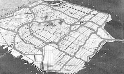
However, if we want to bring mapped conditions into the proposal, how does it relate to a temporal proposal, or does it? We investigated relationships that were not readily apparent in a first look at a map of san Francisco. Does anyone’s ‘discovery’ play into what they are making, outside of some programmatic influence? All streets wider than 20' contain a majority of white people that drink Pete's organic fair trade Columbian dark roast, right?

Also, are ideas that evolve out of mapping, walking, sensing, diagramming, programming, form generation, specific site analysis, general site conditions and eventual scripting rolled up in one big, overarching idea? Are they necessarily related at all? If you had a different idea for how you approached each one of these research project, and you try to roll it all together, shouldn’t it just be one big confused mess? If you actually let the research guide where you would go, these things probably don’t have anything to do with one another. Maybe that’s OK, but how do you decide which thread was most important (to you, to the studio, to the site???)

I think I’ll just go make some nice shapes…

Tuesday, November 6, 2007

yesterday...

...all my troubles seemed so far away,


now it looks as though they're here to stay...

today

Friday, November 2, 2007

Good Link...

Rhinoscripting, whoop!

Instructions:
-click on "keyword index"
-click on "rhinoscript" -> "scripts for 3.x"

These scripts will also work in Rhino 4

thinking out loud


Looking down the unaccepted street-kaleidoscope opens up a myriad of strategies and forms. These streets are envelopes in which anything is possible. Zoning becomes irrelevant: we are building on public land and therefore what manifests as form is what the public desires, or what the specific conditions of site dictate. A top-down regime of this-is-industrial, this-is-that-neighborhood, you-can't-do-that-here, need not apply.

Where I am going: while still interested in the atmosphere of water on the site, my program has ballooned from a hygiene station for truckers to an entire self-contained city above the street. Housing will pay for all the parasitic goodies: rooftop garden (using compost from the dwellers plus the produce district), rain water collection, grey water recycling, trash compaction and re-use. All in the sky. A cloud of housing, a city-cloud.